Noisy Neighbors

Cruising means anchoring in new areas as you explore the waters around you. Along the way, you will find quiet and peaceful anchroages that you will never want to leave. If you hang out in one of these places long enough, the weekend will come and other boaters will descend on these gems, Turing them into bustiling bee hives with boats combing and going constantly. People will swim in the waters amongst the passing boats and the whole area will come alive with commotion.  

By sheer probability, one of these boaters will be equipped with a very loud stereo system and will be on a mission to go deaf as soon as humanly possible. These boats will blare and blast their music all day long as they party and drink until you can no longer stand the noise.  

There is a simply tendency that all of these noisy boaters have in common, they will be a powerboat. More so, they will be a new power boat that is very flashing with all the latest gadgets. 

While it may feel like the noise will never end, there is hope! The owner of this powerboat obviously has a job and needs to return to work on Monday morning. Otherwise, how could he ever afford a boat like that?! 

As the sun sets on Sunday, these floating speakers will raise their anchor and head back to where they came from as the owner needs to continue his routine of work hard, party hard. You, on the other hand, will enjoy the peace as it returns to that quiet anchorage for you are cruising and don't need to pack up and return to port for you are always at home in your floating paradise!

Timeless Sunsets

IMG_1664.JPG

I was recently asked: "You must get to see a lot of sunsets" 

Up until that point, I have taken for granted the fact that I get to see every sunset. I see the ones that light up the sky with a red glow and the ones that fade out into blue obscurity as the night encroaches. Seeing the sun set simply becomes a daily occurrence becuase I pretty much live outside and connected with nature. As the sun begins to go down,I notice it because the sun comes in at a harsh angle, this alerts me to look in its direction and enjoy the splendid display in the sky above me.

Sunsets will never loose their majesticness, but they will lose their count. I honestly have lost count of what day we are, and how many days we have been cruising, as such the number of sunsets I have seen is also lost to me, but the wonder always remains the same. 

This timelessness of the setting sun brings peace to each day as night comes over us and we relax our way to sleep. 

Navigating Without Charts

Current charts are a vital navigational tool. It is far from wise to venture into new waters blindly without a good set of charts, but in the realm of the reckless, it can be done! 

You may find yourself entering a new port where you were not able to get charts for before you left, for one reason or another. The important thing is that you have now found yourself in the predicament where you lack information about the waters you will travel through to get to shore so that you can find charts of these waters. Fear not, as there are ways to navigate without the use of nautical charts! 

Charts will have navigational aids displayed on them, showing you where everything is and helping you find your location and your way. Without the chart, you will need to rely on only these navigational aids. 

The most common and useful aids will be markers (buoys and day markers) and range lights. Buoys mark the channel, which is deep water, deep enough for commercial vessels to pass through. These channels can be wide, and ideally wide enough for you to tack within. Markers are also numerically and color coordinated, allowing you to stay on course and find your way into the heart of the town with ease. Green buoys are numbered with odd numbers, while red buoys are numbered with even numbers. The numbers are set ascending as you enter a channel and lead up to the main harbor. 

If you are out at sea and trying to find your way in, you need to find buoy #1, which would be green. From this buoy, you would then need to spot buoy #2, which would be red, and then search for buoy #3 which would be green. As you make your way up the channel, the numbers will continue to ascend. This lets you know that you are on track and staying in the safer water depths. As you enter a channel, you need to remember the 3Rs: Red Right Returinging. This means that as you return to port, the red buoys pass your right side. 

Buoys are a handy navigational aid, but they pale in comparison to range lights. Buoys require you to constantly search for the next marker as you search for your way up the channel. Range lights serve as a giant beacon that will guide you in with no other aids needed. 

Range lights are two lights setup on shore, the front light is set low, the rear light is set high. When you are in the middle of the channel, the two lights will appear stacked. When you see this, you know you are ready to enter the harbor on a straight shot with no fear of underwater surprises. Range lights are set far apart from each other, so if you are to the left of the center, the lower light will be off to the right side. If you are to the right of the center, the lower light will be to the left.  

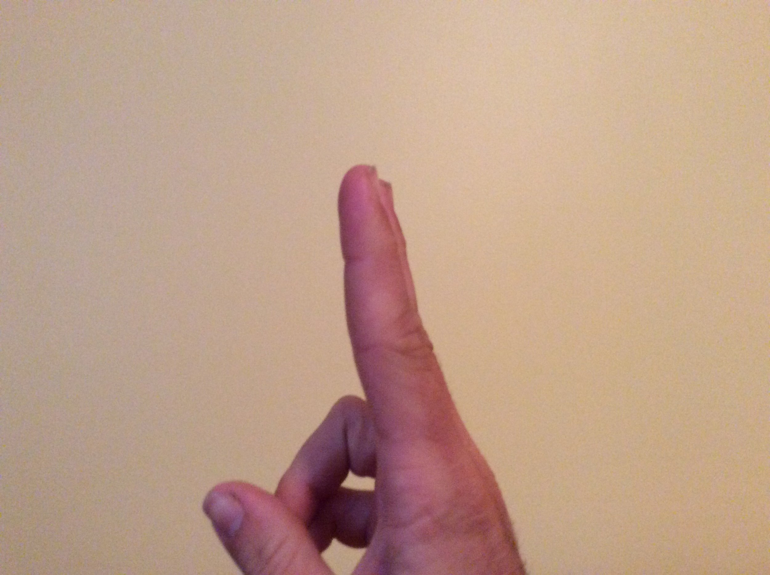
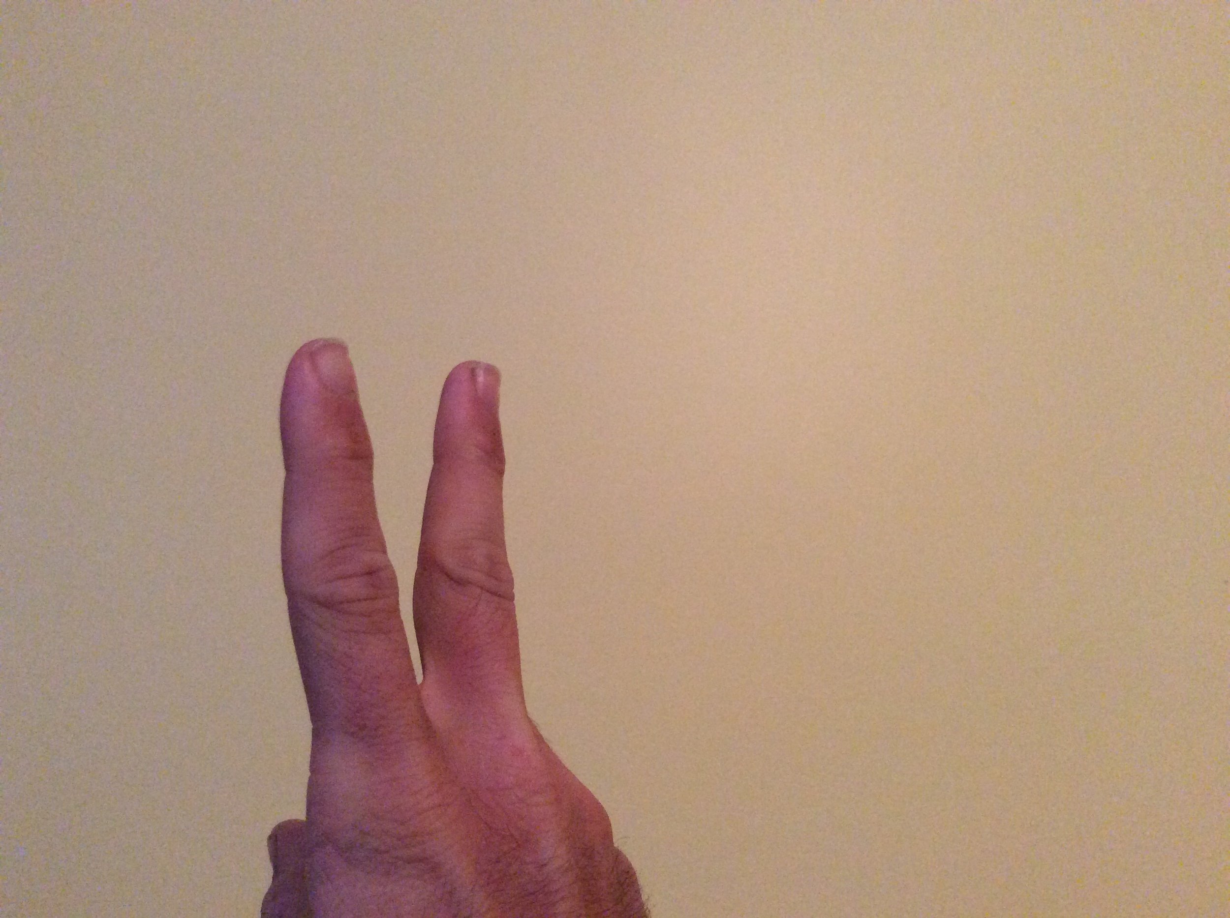
An easy way to figure out the light orientation is to hold two fingers out in front of your face, one set behind the other.  

image.jpg

When you are lined up with the fingers, they appear in a row and the rear finger is behind the front finger. The range lights are set the same way, stacked in appearance from the water. 

image.jpg

If you are to the left of the center, the front and lower light will appear to be to the right of the rear and taller light. 

image.jpg

If you are to the right of the channel, the front and lower light will appear to be to the left of the rear and upper light. 

Finding the range lights and keeping them stacked will keep you in the center of the channel and safe as you make your way into the harbor with no charts, simply relying on the navigational aids setup by those with a profound knowledge of the sea floor below the waves. 

Sailing to Easton, MD

Easton is a small town located at the top of the Tred Avon River on the Chesapeake Bay. This is a quite little town that has one marina that caters more to shallow draft crabbing boats. Needless to say, an ocean going sailboat is not a common sight to see in this sleepy little town. 

Maddie had an art competition in Easton and wanted to go to it while we were out cruising. We had two choices, either stop somewhere and rent a car to drive there or sail there. I checked the charts and saw that the depth in the river leading up to the town is maintained at 8 feet, and we draw 6.5 feet. Naturally, we chose the more complicated way of getting there. 

The Chesapeake Bay is a gorgeous location to sail. There are parts that are so wide that you will not see land in any direction. Directly off of the Chesapeake Bay, you will find the Choptank River, which is also rather large and expansive to be called a river in my opinion. Both of these bodies of water are easy to sail on as you can stay on a single tack for hours without running out of deep water to sail in. Off of the Choptank River., you will find the Tred Avon River. This is where the good sailing ends and careful navigational choices begin. 

The Tred Avon is very narrow as it joins the Choptank, and only gets more and more narrow as you head up it towards Easton. There is no room to tack, and it twist and turns in such a way that the wind will be coming at you from all angles by the time you finish traversing the river.. Wisdom, our sailboat, has a small electric motor with enough battery capacity to get us in and out of a marina, but not all the way up a river! We needed luck, and lots of it! When we entered the Tred Avon, we were on a dead run and sailing wing on wing! The winds were light and we used all we could capture with our light air sails. As we made our way up the river, the banks came closer together, giving us even less space to work with. 

The trees also came closer to us, as they lined the shores edge. Massive oak trees that are full of leaves will stop the wind as effectively as a brick wall! Sailing through this area is tedious, as the wind that reaches your sails is only the wind that has been deflected around the massive trees on shore. This is where further timing comes into play, the tides that is. 

Easton has a 3 foot tide, that means that a lot of water will be coming up the river if you can catch it at flood tide. When the trees block your wind, the tide will still carry you along as you slowly make your way up the river. 

We were very lucky in that it seemed that the wind was always behind us or on our stern quarter. No matter which way we turned, we were either on a broad reach or wing on wing as we sailed along slowly. The journey was going smoothly until I found some shallow water.

The top of the Tred Avon River is popular with crabbing boats that draw only a few inches of water. This has led to less emphasis on the recordings of soundings in this part of the river, as it is deep enough for them to make their way, but not for us. In one section, two points projected out into the river, making it a very narrow pass and the chart said that it was 11 feet deep on the right side of the river. I kept to the right as we struck the bottom and got stuck. It turns out that the deep water is in the middle of the river, as it usually is, even though the chart said the middle was only 2.0 feet deep. The bottom was soft so we weren't worried about damaging our bottom, instead, we relaxed, ate cheese, and waited for the tide to rise. 

Once the tide rose enough, which was 1AM in our case, we floated off the bottom and continued our journey up the river to the town of Easton. When we arrived there, the locals in the marina were shocked to see a large sailboat arrive, especially by sail. We anchored at the top of the channel, which is as far as our keel would let us get to shore and rowed in the rest of the way. 

We only needed to spend 1 day in Easton, but we grew to like the small town and spent a week there exploring the streets and sampling the different restaurants. One gem that will always stay in my mind is an Italian restaurant called "Portofino." The owner and chef is from Portofino and his life journey has brought him to this small town of Maryland where he opened a delicious and authentic Italian restaurant.  

Spending time here did lead to a bit of a phenomenon. Word apparently got out in the town that a colorful sailboat was anchored in the river, and one day we arrived to find five people taking photographs of our yacht. A local new person was even filming her segment with our boat as the background.  

Easton was a very interesting and quaint town. We spent a week there, and just as quietly as we arrived, we also left, riding the tide out of the town and down the river towards deeper and wider waters where we could once again sail to our full potential. 

Guessing Water Depth

Water depth is very important, especially when navigating in a sailboat with a keel hanging low below you. Charts take great effor to dictate and describe the depth of the sea floor to us, usually with little numbers that are provided by someone sounding that specific point in recent history. In popular areas, soundings are taken often and charts are peppered with little numbers confirming that you will have enough water under your keel to safely pass over the bottom. In areas that are less popular, there will be less soundings taken and less numbers on your chart.  

In these cases, your guiding feature on the chart will be the depth contour line. This line is drawn to demarcate where a drastic change in depth occurs. It is equivalent to showing you where a ditch would lie in a field. If you find yourself in less popular waters, you may need to rely on these depth contours to safely navigate your way through the waterway.

If your sailing area is even more remote than that, and the waters aren't even charted, you may need to rely on yet another trick to finding your safe passage.: guessing.

This may sound like a really dumb idea, as you are in a remote area and if you guess wrong, you could possibly loose your yacht, but there is some thought that goes into it. 

The ideal would be to anchor the yacht where you are and run ahead in the dinghy to take soundings. These are your own depth measurements where you can see exactly how deep the water is in varous parts of the river. As you move along, you can get a feel for what the bottom is shaped like and that will allow you to navigate the waters much more safely. 

If you are not able to anchor and investigate with your dinghy, for whatever reason, there is a less ideal method that you can use, and that is to guess the water depths based on the shore lines. Waterways do not exist as special areas of the land that are devoted to the passage of water. Waterways are merely areas of the land that dip below sea level or the local water table. The contours of the land will exist regardless of the presence or absence of the water that flows over it. 

If you see flat lands that lead into the water, you can assume that the land continues on that same angle out into the water. This means that it will be shallow near shore as well as far from shore. The water will very slowly and gradually become deeper as it distances itself from the shoreline. On the contrary, if you see a very steep shoreline, you can assume that it is also very deep right up to the shore.  

Flat lands with rivers tend to have rather shallow waterways. Fjords, on the other hand, have a shoreline that could be confused with a cliff! Fjords are cut out by glaciers, and will be exceedingly deep right up to the cliff wall. When I was younger, I visited Milford Sound in New Zealand. I was astonished that the water depth was hundreds of feet deep right up to the cliffs face!  

If you are sailing near a coast or shore, you can always judge the slope and height of the land and imagine the mirror image continueing into the water. If you see a flat shore, it will be flat and shallow. If you see a hill leading to a beach, it will be deep enough as you approach the shore, but will get shallow as you near the land. If you see a mountain popping out of the ocean, you can probably sail right up to the edge of the land without much fear of bumping something with your keel. 

While these are merely guesses as to the depths beneath the waves, the best tool to have should never be overlooked: good charts and a depth sounder. If you can get good charts, they will tell you about the contours of the bottom and allow you to safely navigate your way through the waters. If you can't get good charts, be cautious and take your own soundings before entering a waterway. If you can't get your own soundings, then guess based on the shores edge.