Sails

Working Sails, Storm Sails, Light Air Sails

You often hear these terms but what do they refer to?
These are terms to describe sails used in different situations.

Working Sails

IMG_2650.jpeg

Working sails are “the normal sails”. These are your mainsail and your regular headsail. The headsail type doesn’t matter: Genoa, Jib, Staysail, Yankee, it doesn’t matter.
These sails are used when the winds are present all the way up to when the winds get strong you need to start reefing.

Storm Sails

IMG_1811.jpeg

When the wind picks up, you start to reef your working sails. Reefing makes your sails smaller but these are still your working sails (even though they are smaller). When the wind gets too strong, you then switch out your working sails for your storm sails.
These sails are your trysail and storm jib. These small sails are specially made for high winds and horrible conditions! The cloth will be incredibly heavy and the stitching will be strong and overdone.

Light Air Sails

3A9845E7-EAC5-4B91-96EC-669FED3934DA-273-00000050E62F21E2.jpeg

The polar opposite of your storm sail are your Light Air Sails. These sails are made of very light nylon that will fly in the lightest of breeze. The conditions for these sails will be from “No Wind to less than 10 knots of breeze”.
Sails that fall into this category are spinnakers, drifters, and nylon mainsails.

Hopefully this cleared up some questions you might have about sail types and the terms Working, Storm, and Light Air!

Dog-bone Dyneema Soft Shackle

Want to replace your steel standing rigging with synthetic standing rigging? Easy!

Simply swap out your steel stays for Dyneema stays.

Now all you have to do is swap out all of your bronze hanks that will chafe on the synthetic stay with soft hanks. These with dog bones are very secure and incredibly easy to operate!

Course While Crossing an Ocean

Everyone tells me that I need a proper diesel engine to cross an ocean safely. Somehow having a motor makes it “safe” and not having a motor (or having an electric motor) makes it “un-safe”. Perplexed, I asked what is unsafe about sailing across an ocean and how would a motor fix these safety concerns.

According to this person (who I wonder if they have ever done any plotting work at all), the safety concern comes from “getting lost".

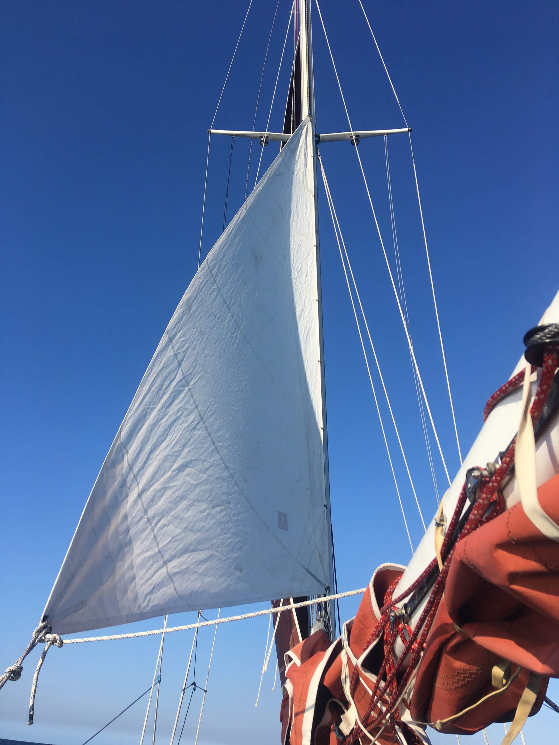
Apparently, when you are sailing across an ocean, you have to sail in a straight line. If the winds are not permitting this direction, you need to lower your sails and motor into the wind, always maintaining this very exact course. If you falter from the course, you will get lost at sea and DIE!

All I can imagine is that this person has no charts and is merely following a specific compass heading. If he gets off course, he is lost and would then die alone at sea! The truth is, charts are a mandatory item to carry on the boat, along with all the necessary equipment needed to plot your position at sea.

While electronic charts are convenient, you still need to carry paper charts with you so that you can navigate even if all Hell breaks loose! Imagine getting struck by lightening, frying all your electronics, then a wave splashes into the boat and all your remaining electronic gizmos get soaking wet with saltwater and perish. If this is all you have for navigation, then you will soon fall into the guys narrative about why you need a diesel. If you have paper charts, then you will be able to navigate mostly accurately after you dry out the papers that got wet with that same wave. The ink might run and smudge, but you can still generally see where you are and where you are going!

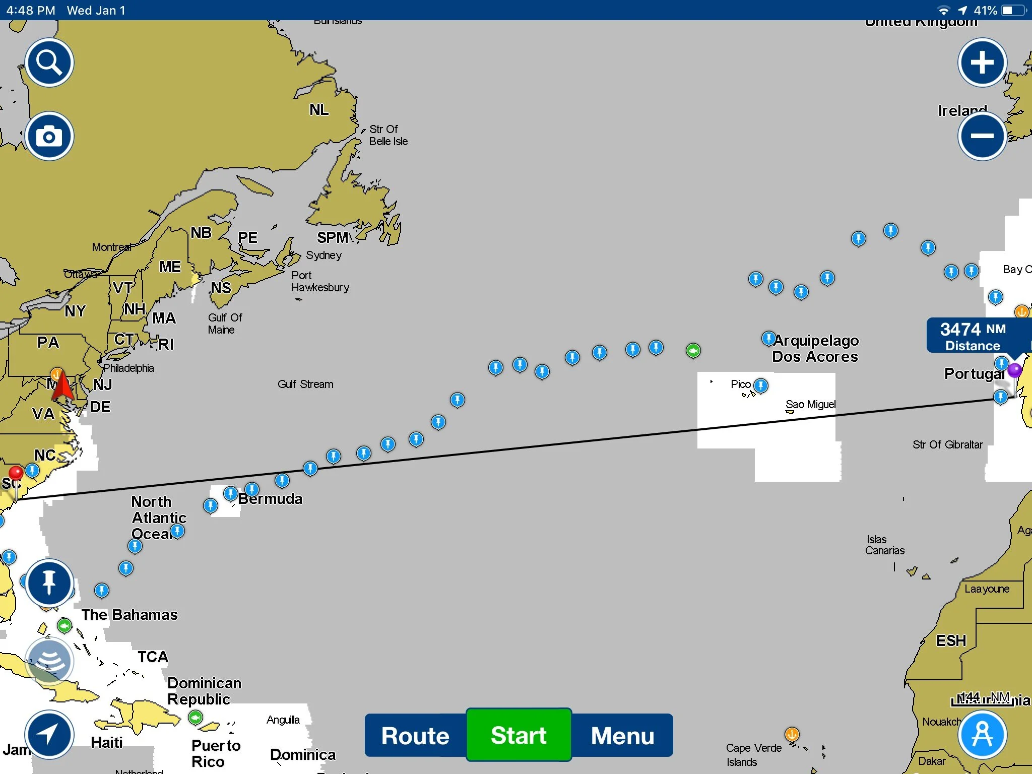
Now, why is it Not un-safe to sail across an ocean without a proper diesel motor? Because course is kind of a joke on long passages. Imagine that you are sailing from the United States to Europe. What heading would you need to sail? 64*, 77*, 90*?

The correct answer is: “No one cares!”

Europe is East from the United States, so when you leave port, you will sail as far from land as you can, then head East. If the winds take you a bit North, then you will sail North East for a while. If the winds blow you a bit South, then you will sail South East for a while. Eventually, you will cross the Atlantic Ocean by sailing East with the winds you have as they are presented to you.

Let me explain with some actual numbers. Lets say you are leaving from either Charleston, SC or Southern Florida. These two points are 350 nautical miles apart, yet if you leave from either of them heading for Lisbon (and assuming there is no land in the way) your course will not be very different.

IMG_5338.jpg
IMG_5341.jpg
IMG_5342.jpg

Leaving from Southern Florida, the direct line course is 79* and 3644 nautical miles long.

IMG_5339.jpg
IMG_5340.jpg

Leaving from Charleston, SC, the direct line course is 84* and 3474 nautical miles long.

What does this mean? This means that if you start sailing from either point, you will sail really far for a really long time with a variation in heading of only 5*.

Five degrees of heading variation from a two starting points that are 350 miles apart. That is quite the difference in starting places and yet the heading is almost the same. Now, in the world of the guy who is frightened to not have a motor where you only have access to charts when on shore, you know where you are when you are on land because you can just ask someone where you are. Imagine if you are out at sea and don’t have anyone to ask? Well, you can vary your position by 350 nautical miles and still generally sail in the same direction without any ill effects on your heading.

This became very apparent to me when we were sailing out in the ocean and spent a full day heading North to avoid a storm at sea. After we sailed past the storm, a full 100 nautical miles off course, our new heading was identical to our old heading. Nothing had changed because we are so far away from our end destination.

Imagine the course as a triangle instead of a single line. The base of the triangle is the line between where you start and where you want to reach. The height of the triangle is how much you venture off course. The hypotenuse is simply connecting where you are to where you want to go. If you have a long enough triangle, the height of the triangle becomes inconsequential as the triangle will merely look like a straight line and not a triangle. If you get significantly off course and the height gets significantly higher, then the triangle will still have a very acute angle which would be the variance you now need to correct for.

In our earlier example, when you are about 3000 nautical miles away, a 350 nautical mile height makes a small acute angle of only 5 degrees at the end destination.

The moral of the story is, sail around weather and don’t worry too hard about your course. Once you get closer to your destination, then you can start plotting your position more closely and actually caring about your heading. As long as you are far away from your destination, all you need to do is sail in a general cardinal direction towards your destination.

Having a sextant and a clock will grant you the ability to plot your position on the high seas and from that you can plot your position and calculate your desired heading as you approach your destination. Every day at noon, I would simply plot our position on the chart and if an adjustment to our course was needed, it could be carried out. The distances were great and stress was low on this passage. We simply sailed to the winds we had as each day came upon us. If you see our course, it varied quite greatly from the straight line course as we made our way across the ocean. At no point did we feel “lost” or “un-safe” while sailing across the ocean.

Azores to Portugal: Day 6

A low pressure is passing by us and giving us some wonderful South winds. These are a welcome change as they mean we can make some East miles! 

We could use these South winds to run due North and make that distance needed, but why not try and get as far East as we can?

Our goal is not to hit a particular latitude, our goal is to hit Porto, Portugal. 

Traditionally, the winds in this area require you to sail North to around 47N, but that is not a hard and fast rule. The winds lately have been really weird, so the choice is to sail to an arbitrary point or try to sail to our destination.

For the sake of morale on board, we choose to sail towards Portugal and shave our distance to destination down a bit.

Is it a yawl?

The definition for a yawl is pretty clear cut:
A two masted sailboat where the aft mast is shorter than the forward mast and the aft mast is set aft of the rudder post. 

So what is this? 

IMG_5759.JPG

This yacht is over a hundred years old and categorized as a yawl even though the mizzen is forward of the rudder post. Why?  

Well, first off, this yacht has a transom hung rudder, so the only way to get the mizzen aft of that is to set the mizzen on the end of the bumkin!  

The rules are pretty clear cut and yet at the same time, there are always exceptions.