
So often, we are looking at the sky for clues from the clouds about the weather to come. Anvil clouds indicate a severe storm approaching and the horn of the anvil indicates its direction and affected path.
We always look up at these towering structures in the sky, but on our flight back to the boat we had the opportunity to gaze upon that same structure from a new vantage point!

Getting Weather Information in the Middle of the Ocean
Weather forecasts are a wonderful thing, they can tell you if it will rain or be hot out, but they aren’t perfect. How many times do you see 50% chance of rain? That’s the same as saying: “it might rain today, but it might not”.
The problem with forecasts is they are being fed to a very large area and each individual area in the larger region might not actually have the same weather as the forecast. The best way to get your local weather is to figure it out yourself. This is not going to be a “broad forecast for a large area” but instead a “targeted local forecast for your immediate area”.
The best part about this method is that it doesn’t require you to have a connection. You know all those weather apps on your phone, if you don’t have internet access, you don’t have a forecast. When you head offshore, there is no signal and no reception. Your options are to either pay a lot of money to receive satellite internet or to produce your own weather forecast from your own observations.
All you really need to accurately determine what winds will come your way are a barometer and a weather eye.
Transatlantic: Azores to Portugal: Day 18 [Day 66]
The trade winds are present and we are moving at speeds and comfort like we have never moved before!
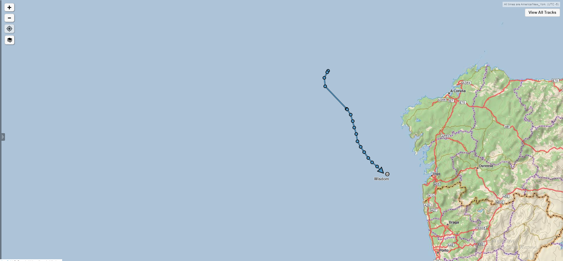

Day 18 and still no sight of land. The date is June 30, 2019 and we are almost there!
The trade winds seem to be stronger near shore, which means that the close we get to shore the stronger the winds will be and the faster we will be moving along. All was fine with our course until we came across a separation scheme off the northern tip of Spain. All the traffic coming out of the Mediterranean and bound for the English Channel will want to pass close to this point of land. That means that there is a lot of ship traffic and as a result there is also separation lanes dividing Northbound ships from Southbound ships.
The problem is we want to cut closer to land so that we don’t get swept away by the current and miss our harbor, but our course had us cutting right across the lanes! We sailed along in the outermost Southbound lane and once we were clear of the separation scheme and there was space between all the cargo ships, we cut along towards shore where we could be certain we would not miss our destination.

This might be our last night out at sea on the open ocean for a while, so we took special care to appreciate the sunset we were presented with. While it is beautiful, it forewarns of winds to come.
You can see that we are in a cloudless area with a relatively high pressure. The sky is clear until it reaches the wall of towering clouds in the distance. The red hue on all the clouds is caused by the refractive lens of the high pressure we find ourselves in, making everything we look at in the distance display a "red shift”.
What this tells me is that we have calm and wonderful conditions at the moment, but that will change when those clouds approach. The base of the clouds is not visible which gives some clue to their distance away. The bottom of these low level clouds tend to be around 3,300 feet above sea level. The bottom becomes visible when the clouds are about 100 miles away. The tops of these clouds can reach 60,000 feet above sea level, which can be seen from about 300 miles away. Being how we see the tops and not the bottom, we can assume that these clouds are somewhere between 100 and 300 miles away from us!
The clouds billowing up into the sky demonstrates great atmospheric instability over there and it is all occurring in a line. This means that when the cloud line approaches, the winds will jump from calm to insane in a hurry so we need to prepare ourselves for this wind before it arrives (or make it to our port before it gets to us).
Guiding Clouds
Sunset is always a magical time of day. The sky takes on a wide palate of colors, making the sky look like if God got creative with his brush!
While sailing down wind with an approaching cold front, the whisky cirrus clouds stretched out overhead with wonderful streaks of colors.
We have been having a significant lack of wind lately and these clouds symbolized the promise of wind in the right direction to come!

Transatlantic: Day 25 [Day 46]
Aug 1st, 2018. We have now entered the Azores, and with great speed too! Our average speed for this 24 hour run was a whopping 5.5 knots.
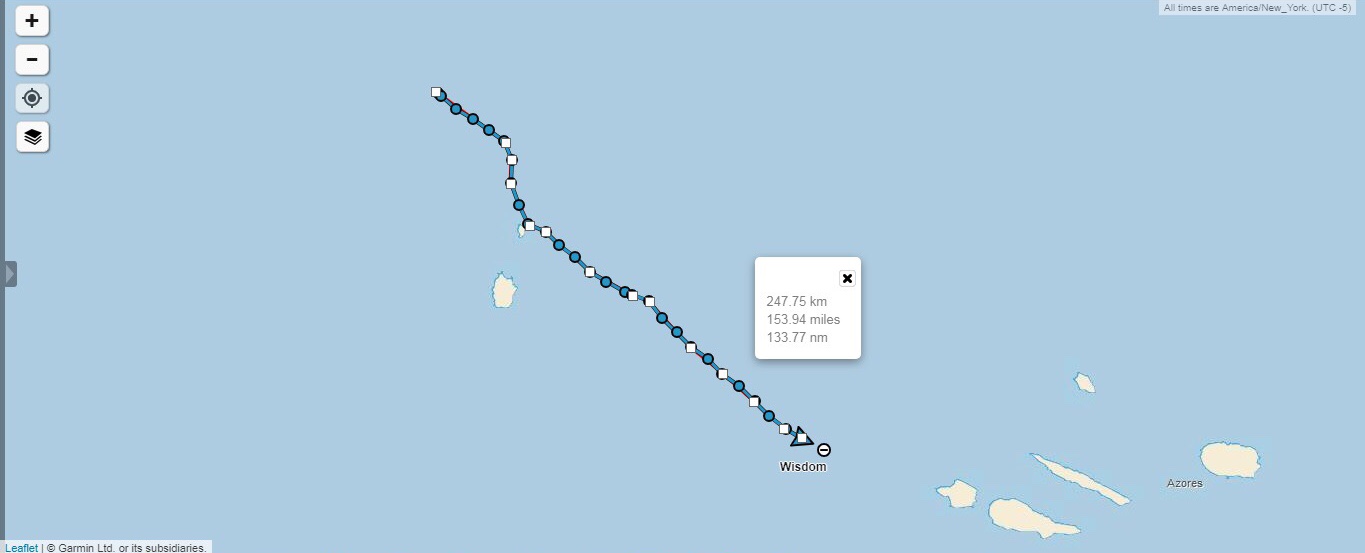
At dawn the horizon was still empty, but I knew land would be visible soon. We decided to sail close to Corvo because we wanted to see some land before we made our way into the archipelago.

While the horizon might look like more water, there is a give-away written in the clouds! All clouds move, but clouds over an island will tend to be stationary.
While staring ahead, I noticed that the clouds just above and to the left of the gate never seemed to move. All the clouds were moving from right to left over the horizon, but those clouds were stationary. LAND!

We kept sailing in that direction and soon I could see the faint outline of the cliff sides of Corvo rising up out of the water!

A while later, we were several miles closer to the island and the outline of the landmass seems more pronounced on the horizon.

The original plan was to sail between Corvo and Flores as we entered the Azores, but I was worried about wind shifts from the cape effect as we passed through the narrow straight between the two islands. I was also concerned with the current that might exist in there as the tidal waters moved from East to West. According to the tide tables, it was supposed to be high tide, so we might be approaching the pass at peak ebb tide and be pushed back unnecessarily!
Instead of risking it, we simply put Corvo on our starboard bow and continued to make our way towards it.


We passed the island on the North side and stayed close enough to appreciate the beautiful sight of land but far enough to keep safe from the dangerous shores that we saw before us.

Passing the island on the North side while sailing on starboard tack means that we were not going to have a lee shore, but we would have to negotiate with the islands wind shadow. The wind shadow of an island can extend for miles, as it is roughly 8 times the length of the objects height. On a massively tall island like this, the wind shadow could easily extend for miles out to sea. Thankfully, the island is small so the wind shadow would be short lived as we drift across the waters while being pushed by the current.

As we neared, we were graced by the presence of something we hadn’t seen in a while: birds.

This guy looks like a brown albatross from a distance, though I am not a bird watcher by any measure. It was merely massive, huge, glided around without flapping its wings, and had a beak that resembles that of an albatross. Most importantly, this bird has land behind him!

We have now entered the Azores and were close to our next port.

We passed rather close to Corvo and once clear of the wind shadow, made our way towards Faial. Horta is located on the SE side of the island, but the winds were acting kind of fluky, so I decided it would be best to head straight there in as short a distance as possible. If we could get close to the island, we could then day sail our way into port without any major distances to cover. If we hedge our bets on what the winds will do, we might find ourselves far off with the wrong winds and no motoring ability to correct the mistake.

Seeing land after 25 days is magical. The horizon used to always be empty, and all of a sudden, there it is, the missing vision we have been searching for!
