Hiking

Hiking in Flores

Flores, in the Azores, has gorgeous sceneries and a vast network of trails that you can venture around. The landscape reminds me of a mix between Jurassic Park and Lord of the Rings. Everything is lush and green, but the ferns make it feel a little Cretaceous. The islands range in age from 8,120,000 years old (Santa Maria) to 270,000 years old (Pico) , but the landscape could easily make you feel as if you were 100,000,000 years ago, when flowering plants were really beginning to diversify!

The landscape seems like a goats playground, everything is vertical and rocky with very little mud around, as all the dirt is carefully held in roots, while the red mud-looking surface is actually red volcanic rock! Hiking here is fun for a while, but then you get tired! Up and down, then through a stream and up again! If only there was an easier way to see these natural splendors without all that walking? 

IMG_3190.JPG

There is! Most of the long trails flank the roads of the island. You can easily drive to the gorgeous landmark, see its beauty and then hike a little on the trail that would have gotten you there. 

Maddie and I did this a lot! Some of the trails are rediculously long and would take up your whole day, just to see one magnificent waterfall. For example, one trail is 7km long, one way! It usually takes people 3.5 hours going (it’s uphill) and 2.5 hours to return (it’s downhill). This means that 6 hours of your day have been consumed to see this one trail which, honestly doesn’t take you to that beautiful of a place! If you had hiked that trail, you would not have had time to see the other waterfalls on the island that day.

If hiking is your thing, you will probably be able to hike all the trails on the island in a week. If hiking is not your thing, or you are not in the greatest of shape, then it will take much longer than a week to hike all of it! This is where driving to the end comes into play, you hop out of the car and hike the last bit to the beautiful waterfall, then off you go to the next spot! This might feel like cheating, but most of the waterfalls are about 500 meters away from the end of the road, so you will still hike about a kilometer for each feature.  

Take your time and explore the Azores at your own pace. If you want to hike, you certainly will find yourself in a playground. If you don’t fancy yourself a hiker, you can still see the wonderful views with the aid of your vehicle (and a little walking). 

Flores Paths

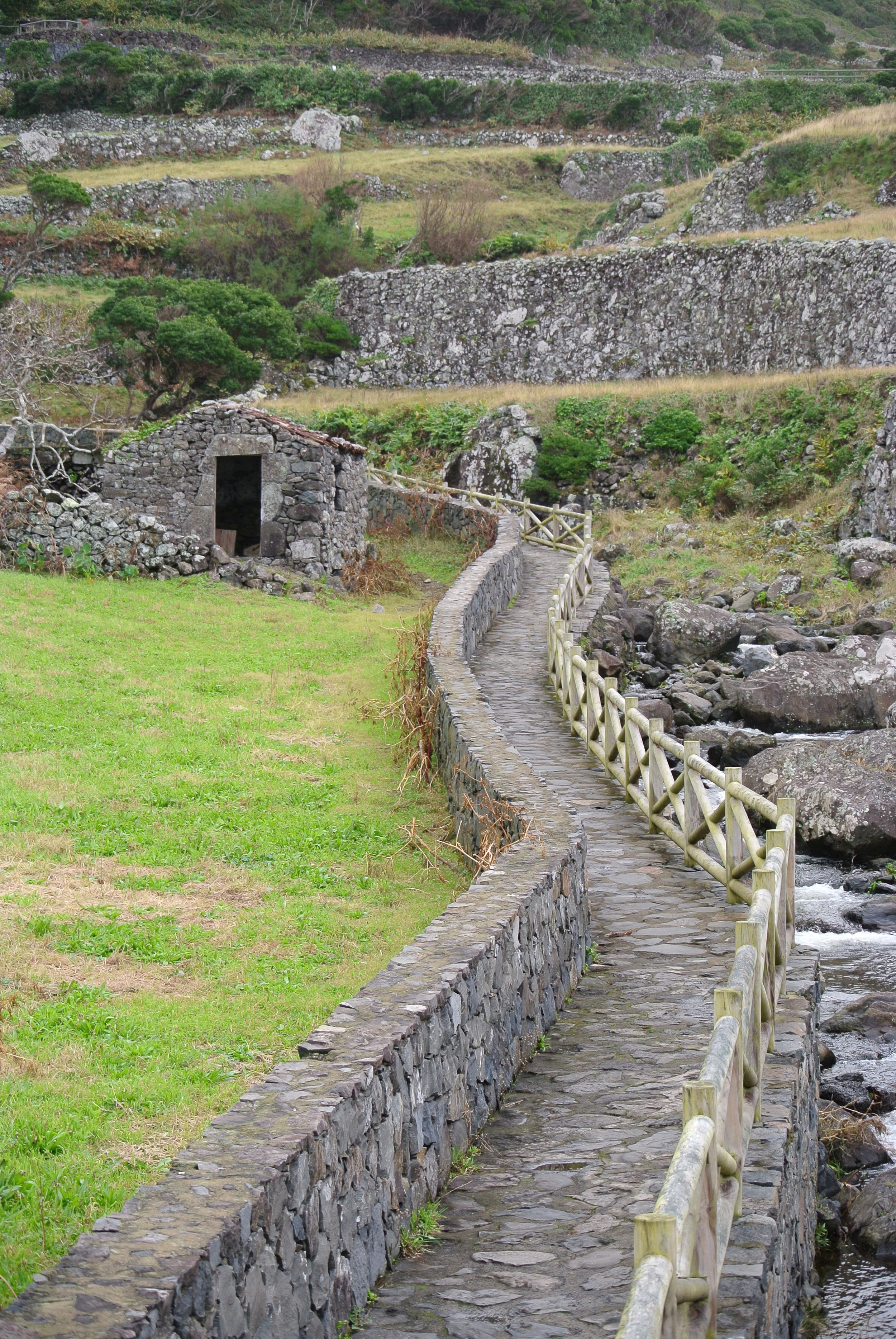
The island of Flores seems to have more cows than people, and the majority of the island seems to be covered by fields instead of buildings. In these fields, there are no roads, but instead neat little walkways. Some are stone, some are red volcanic pebbles, some are grass. They will work their way through the fields and along old field houses that are in varying levels of condition. 

IMG_3200.JPG

When you walk back through these fields, you will stumble across majestic views that your car could never reach! You will find streams, waterfalls, and forests that have grown around lakes that are deeper into the island. 

This one path follows a river up to the cliff where a thin and wispy waterfall coats the sides of the rocks with a thin mist.

Twin Lakes

These two lakes are actually the remnants of two volcanic craters that were responsible for forming this part of the island a few million years ago. The lake on the right is actually used as the water reservoir for the entire island.  

IMG_3849.JPG

During the rainy season, the lake will fill up and carry the entire water needs of the whole island through the dry season, when little rain falls to replenish the supply.  

These two lakes are considered a prime hiking destination, and listed on travel sites as a priority to see when visiting Flores. Then they go on to say that the only way to access the two lakes is via a 7km hike (one way, then you have to turn around and walk home)! I had heard that one of the lakes was a water reservoir, and knew there was no way that a government worker was going to hike 14 kilometers just to check on the lake. There had to be a road somewhere! 

So, we looked at the map and found that the lakes are located right next to a major highway on the island (which is a two way street with a dashed line down the middle of it) and that there was a small “service road” that forked off of the highway and led straight to the lakes. 

We went for a little drive and figured that we would at least be a lot closer to the lakes if we drove than if we started from miles away!  

Well, the service road ends in a parking lot that has some steps next to it. Maddie and I walked up the steps, maybe 100 meters, and this was the view! We could not believe that the trail ends at a parking lot, so we went exploring a little.

We found where the trail ends and began hiking it a little to see where the trail would go, and what the trail looked like. We snaked our way through a field and along the edge of the lake on the right, only to come out to the highway. Yes, the trail flanks the highway and at many points the trail “is” the highway. 

By driving to the lakes and skipping the 3 hour hike (one way), we were able to visit many more beautiful attractions and sights that this island has to offer. We did hike a little that day, but no where near the 14 kilometers that would have been required to get to these lakes, only to see a parking lot right next to the view we had worked so hard to see.