
After our fateful storm off "The Graveyard of the Atlantic" where we headed out into what seemed like calm weather and insufficient wind to carry us the needed miles, followed by a drawn out and intense storm; we have started looking into a proper weather routing system.
A quick google search of weather routing will yield a wealth of options, all are programs and none are information. I thought this to be rather odd, because I wanted to learn more about weather routing and not ask a program for an answer.
Most of these programs charge for their use, but some of them are free! Now, having a good weather program sounds great when you are on land and connected to the marina's WiFi; but when you are offshore, everything changes! Power to run your computer becomes a taxing draw on your battery bank and all this distance from shore means that WiFi signals are a faint memory. Getting internet on your boat when you are still close to shore is possible by using your cell phone as a hotspot, but when you are out of range of cell phone service, the solution is very expensive.
Iridium Go is a viable solution until you price the package out. The unit itself costs around $1,000 and the subscription costs between $50 and $200 per month, depending on which plan you sign up for. Mind you, this unit and plan are considered to be the most economical method of getting internet on your boat while out at sea!
So, the weather routing software is expensive, and the connectivity to use them where you would need them is also expensive. Instead of bursting our budget of $500 per month, I decided to dig a bit deeper. While these programs calculate the best route to get from Point A to Point B, the program itself was written by a human, so there must be some theory that the programmer used to base the calculations on.
Playing around with a few programs, I noticed a trend emerging with the route that they would suggest. They all seemed to follow the 1020mb isobar line. Any two points, anywhere on the map, the route always seemed to follow this isobar as best it could. This was my first clue into an enlightening discovery.
While 1020mb may seem like an arbitrary isobar, this region is known for having mild and steady winds. If the pressure is greater than 1020mb, you risk reaching the center of a high pressure system where the wind vanishes, and if you venture into areas where the pressure is less than 1020mb, you risk running into a low pressure system with its associated storm conditions. It seemed that there was something magical about 1020mb.
In further reading, I found a review of 5 popular (payment required) weather routing programs posted by Sail Magazine.At the end of the review, the author noted that all of these programs "...aim for a course very close to the 1020mb pressure isobar. There’s something to be said for the old-timer’s simple route planning." (Source: https://www.sailmagazine.com/cruising/weather-routing-101-part-2)
That line: There's something to be said for the old-timer's simple route planning. That stuck out to me as it confirmed that the weather routing programs that charge are also following along with the 1020 isobar line!
When following this line, the winds appear to be steady and uniformed in the same direction as it revolves around a high and low pressure system. The winds circulating around a high pressure system will always rotate clockwise while the winds circulating around a low pressure system will always rotate anti-clockwise (in the Northern Hemisphere). Knowing this, it is possible to pick a downwind route from any Point A to Point B by following the 1020mb isobar around high and low pressure systems!
A while back, my dad offered me his grandfathers barometer to take with us on our voyage. At the time I declined the offer because I didn't see an immediate need for it and didn't want to risk its safety while on board. I would forecast the weather by looking at the clouds and found no need for a barometer as the clouds would tell me if the pressure was rising of falling based on their formations.
Now that I know we want to follow the 1020mb isobar, I suddenly had a use for a barometer and took my father up on the offer to borrow his grandfathers barometer (my great-grandfather). The line from that review "old-timer's simple route planning" struck in my head as I looked at the face of the barometer!

This barometer is certainly old, being a gift from my grandmother to her father in 1950, about 68 years ago!
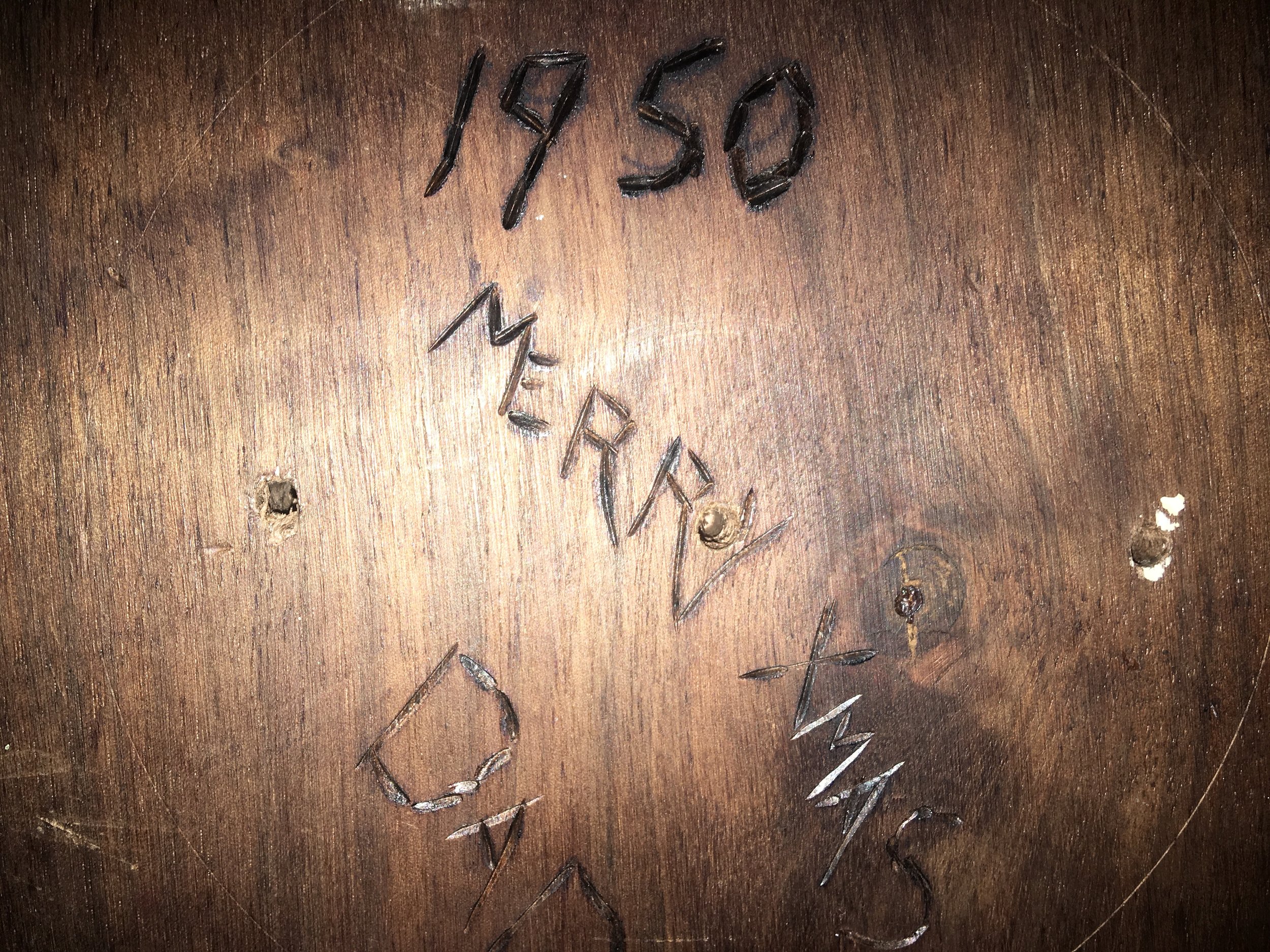
Note how under the 1020 millibar number, the word is "Fair". Seems that the old-timers made barometers and weather routing simple and easy to do. Keep the needle on "Fair" and if the pressure starts to change, alter course based on the wind to bring your yacht back into the "Fair" isobar.
This is easy to do without any fancy weather instrumentation or connectivity, all you need to do is stand outside and point! Thanks to the Coriolis Effect, when you stand face into the wind and extend your right arm straight out to your side and point, you will be pointing at the center of the low pressure that is causing these winds.
If the pressure is dropping, you are too close to the low pressure system and need to alter course away from it. If the pressure is climbing, you need to sail closer to the low pressure system.
The concept sounds simple, and if you look at current weather charts, you will see that the winds along the 1020mb isobar seem nice, ranging from 15-20 knots of wind along the entire route; but reality always has a way of rearing its ugly head.
Weather is not stationary. The 1020mb isobar will not stay where it is and allow you to sail around the world along this magical corridor of good weather. Nay, it will move around as the high and low pressure systems of the world dance around the surface of the Earth, causing the isobar to move, sometimes quicker than you can move your yacht. This means that while you may intend to stay in the 1020mb isobar, the 1020mb isobar may move away from you at a speed you can not match, and you will get caught in foul weather from time to time as you voyage.
This is a fact of cruising, but knowing what to look for in the weather and how to route your course to improve your chances of good weather is imperative to a happy cruising experience.
So, before you sign up for a complicated and expensive weather routing program and service, consider doing what the old timers used to do: sail where the weather is "Fair" on their barometer.
